Skip to content
The San Diego List*
WEEKEND
Home / Things to Do / The Anza-Borrego Day Trip, Planned for the Cool Months: 7 Stops

The Anza-Borrego Day Trip, Planned for the Cool Months: 7 Stops

A seven-stop Anza-Borrego route from first light to dark sky, with the current Palm Canyon closure, the honest Font's Point 4WD rule, and no padded desert detours.

How we rank: every place has a verified Google or Yelp listing; both are attempted, open status is checked, and evidence is dated.Road status, trail closures, seasonal hours, ratings, and dark-sky logistics re-verified July 19, 2026
Updated Jul 19 · 3 min · By The San Diego List
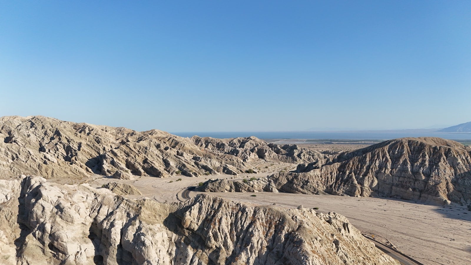
Eroded badlands stretching across Anza-Borrego Desert State Park

This is a cool-season route, not a challenge to see how much desert can fit in one day. The seven stops move in actual travel order, with opening times, heat, road access, daylight, and darkness deciding the sequence. Anything that breaks that logic stays out, no matter how famous it is.

The Slot occurs before the Visitor Center only because first light is the safer window. That means pre-trip verification is non-negotiable. Palm Canyon follows the ranger stop, lunch breaks the exposed part of the day, and the sculptures lead naturally toward the final viewpoint and night-sky decision.

Do not add a second major hike just because the map looks empty. The San Diego hike guide has better standalone trail comparisons. Readers planning to sleep in the park should use the camping guide, where reservations, fire rules, and overnight access receive the attention they require.

For a mountain-town day with reliable indoor stops, choose the Julian itinerary instead. The broader things-to-do guide is the right fallback when the desert forecast, road table, or driver condition fails this plan.

The map
1234567
Ranked locations · exact streets
Boundary fallback · connect MapTiler for street detail
Focus spotsHover, focus, or tap
01
BUTTES PASS — PRE-TRIP CLEARANCE · 2WD BASELINE · FLASH-FLOOD RULE

Enter The Slot at First Light

The Slot is the one dirt-road segment completed before the Visitor Center opens, so every condition check happens before leaving San Diego. State Parks' February 2026 baseline marks Buttes Pass to The Slot 2WD/good, but that means sand and washboard—not a permanent guarantee. Download the route, confirm weather and road status, and reach the narrow sandstone passage during the coolest light. Rain anywhere relevant to the drainage cancels the stop. Do not let navigation reroute a standard car through a rougher wash.

02
PALM CANYON DR — $10 LOT · RANGER RESET · SEASONAL SCHEDULE

Anza-Borrego Visitor Center

4.8 Google (1,820) Verified Jul 18, 2026

Reach the Visitor Center when it opens and rebuild the rest of the day around what staff know now. Maps, exhibits, the park film, native plants, and ranger guidance make this more than a bathroom stop. Ask specifically about Palm Canyon, Font's Point Wash, heat, wind, and any road affected by recent rain. From October through May the indoor center operates daily; from June through September it currently drops to weekends and holidays, while the parking gate follows its own schedule.

03
PALM CANYON — $10 DAY USE · 3 MILES · GROVE CLOSED

Borrego Palm Canyon Trail to the Current Grove Viewpoint

4.8 Google (309) Verified Jul 18, 2026

Palm Canyon remains the route's signature hike, but the destination has changed. The rocky canyon still carries desert ecology, possible bighorn sightings, and a view toward the native fan palms. The first grove itself remains closed after fire damage, and the legal trail ends at a viewpoint overlooking it. Start in the morning, carry more water than a coastal three-miler would require, and give wildlife distance. The honest endpoint is still worth the walk; the invented recovered-oasis finish is not.

Let us decide your next San Diego move.
Verified openings, one neighborhood plan, and the places worth booking. No filler. Join the early list. We’ll email you when the first issue launches.
By subscribing, you agree to receive The Shortlist. Free; unsubscribe anytime. See our privacy policy.
04
BORREGO SPRINGS — $$ · LUNCH RESET · DAILY 11–9

Carlee's Place

4.4 Google (1,460) Verified Jul 18, 2026

A desert itinerary needs a real recovery interval, and Carlee's is the verified central-town option that makes the route work. The menu is broad: burgers, sandwiches, salads, Mexican plates, cold drinks, and enough indoor time to refill water and reassess the afternoon. This is a logistics pick before it is a culinary pilgrimage. Current feedback is mixed on peak pacing and some dishes, so order simply, eat before the room fills, and use the break to recheck wind and road conditions.

05
BORREGO SPRINGS RD — FREE · 130+ SCULPTURES · USE THE 2026 MAP

Galleta Meadows Sculpture Loop

4.8 Google (537) Verified Jul 18, 2026

More than 130 metal sculptures across roughly 50 groupings turn the valley into a drive-through desert story. The serpent is the headline, but extinct animals, dinosaurs, farmworkers, and present-day wildlife make the loop richer than one roadside photograph. Use the Under the Sun Foundation's March 2026 map to connect the south and north clusters once. The art sits on a private preserve open to respectful visitors; existing tracks are access, not an invitation to carve a new shortcut.

06
S-22 — PAVED DEFAULT · FONT'S POINT 4WD ONLY · DAYLIGHT EGRESS

Use the Paved Montezuma Grade View by Default

The standard itinerary takes the paved Montezuma Grade perspective over the desert floor. Font's Point is not the default. The current State Parks road table marks Font's Point Wash 4WD/poor, with deep sand and difficult S-curves even for four-wheel-drive vehicles. Only substitute it after a same-day ranger, road, and weather check, with proper clearance, recovery equipment, enough fuel and water, and time to enter and leave in daylight. If any part of that sentence feels excessive, stay on pavement.

07
BORREGO VALLEY — FIVE MAPPED OPTIONS · SCOUT BY DAY · WEATHER DEPENDENT

Finish at a Mapped Borrego Dark-Sky Pull-Off

Darkness is the requirement, so this stop belongs last. Before the paved viewpoint leg, scout one of the Borrego Dark Sky Coalition's five mapped locations with suitable parking—such as the north end of Di Giorgio Road. Return only if the vehicle can sit fully off the roadway and all posted access remains legal. A new moon helps, but clouds, wind, headlights, wildlife, or a tired driver can erase the payoff. The designation proves the region protects darkness; it does not make every shoulder safe.

FAQ
Answers to what people actually search.

When is the best time for an Anza-Borrego day trip?

Plan this route for the cool season, generally October through April, and still check the exact forecast. Summer heat can be life-threatening, the Visitor Center reduces indoor operations from June through September, and Coyote Canyon closes seasonally from June 1 through September 30.

Do you need four-wheel drive in Anza-Borrego?

Not for the standard version of this route. The Visitor Center, Palm Canyon, Carlee's, the sculpture areas, and the Montezuma Grade drive use paved access. The currently posted baseline rates the Buttes Pass approach to The Slot as 2WD/good but sandy and washboarded. Font's Point Wash is 4WD/poor with deep sand and is only an optional daylight substitution after a same-day check.

Is the first Borrego Palm Canyon grove open?

No. State Parks still shows the first palm grove closed after fire damage, and the current trail ends at a viewpoint overlooking it. Do not repeat older descriptions that promise a walk into the recovered first grove.

Where should you park for stargazing in Borrego Springs?

Use the Borrego Dark Sky Coalition's current map of five popular locations with suitable parking. Scout the exact pull-off in daylight—such as the mapped north end of Di Giorgio Road—then return only if the surface, posted access, traffic, moon, weather, and driver fatigue are all safe.

Can you do this route in summer?

We would not use this itinerary in summer. Extreme heat, reduced Visitor Center service, seasonal campground and road restrictions, and a long drive home after dark create a poor risk-to-reward trade. Save the desert for a cool forecast rather than trying to outsmart the season.

About the author
The San Diego List blue asterisk editorial mark
By

The San Diego List

Independent San Diego guide publisher

The small crew of San Diego locals behind independently ranked restaurant, neighborhood, event, and activity guides — grown from 200,000+ combined Instagram followers into a research-driven publication.

Read this next
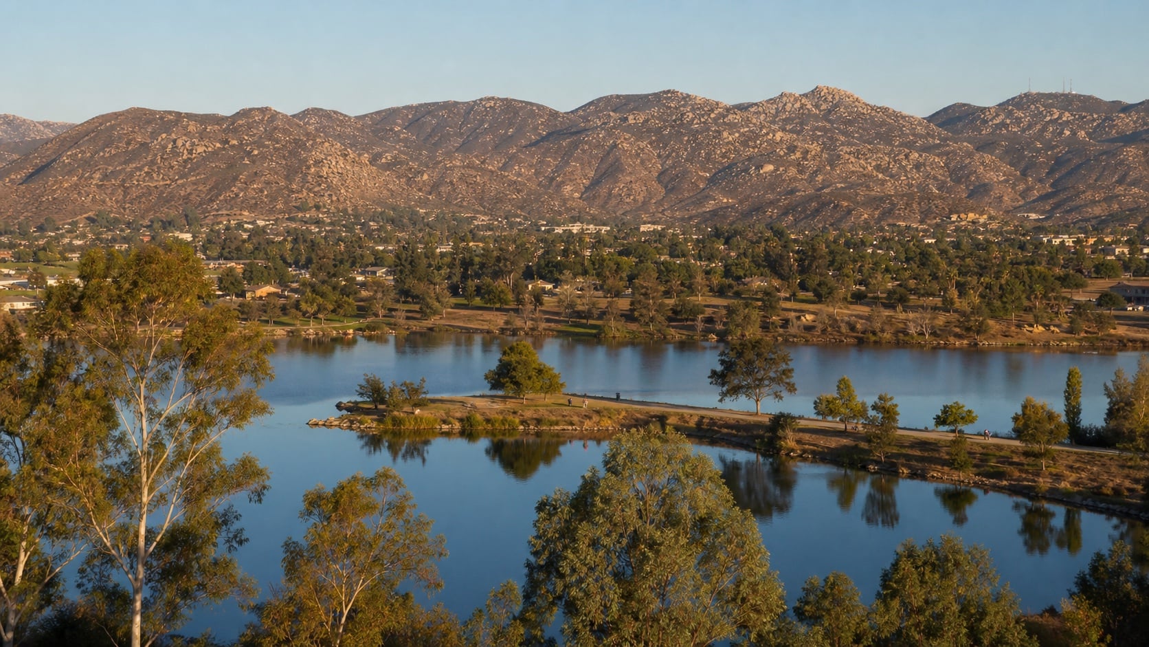
Blue lakes below Santee's granite foothills in late-day light
Up next · Santee & Lakeside
5 Places Worth Your Time in Santee & Lakeside, Ranked

Two very different lake days, a river-corridor walk, a compact backcountry loop, and the disc-golf round that earns its place in the plan.

5 ranked · Updated Jul 20 · Keep reading →
More like this
Camping
The 8 Best Campgrounds in San Diego County, Ranked
8 ranked · Jul 19
Hiking
The 12 Best Hikes in San Diego, Ranked
12 ranked · Jul 19
Day Trips
The Julian Day Trip, Planned Properly: 8 Stops Worth the Drive
8 ranked · Jul 19